Sauropod Trackways Discovered in Dorset
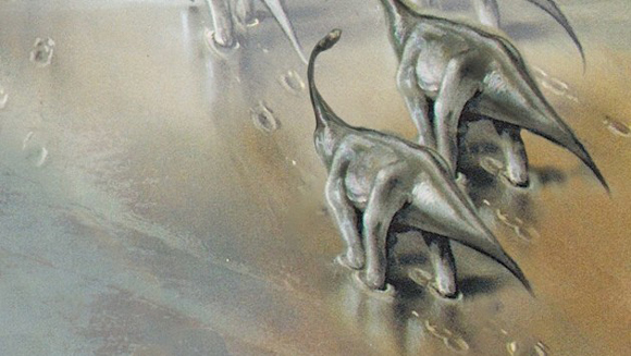
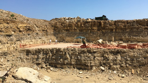
Scientists have been measuring and mapping a set of dinosaur tracks found in a quarry in Dorset. The saucer-shaped tracks were made by a herd of long-necked sauropod dinosaurs that crossed a stretch of a tidal lagoon back in the Early Cretaceous. The quarry is located close to the village of Worth Matravers, around three-and-a half-miles east of the coastal town of Swanage, on the Isle of Purbeck.
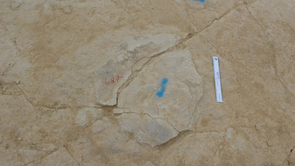
A View (Dorsal) of a Dinosaur Footprint (Sauropoda)
Picture credit: Bournemouth University
Giant Dinosaur Tracks
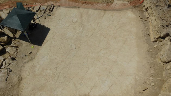
The group of large dinosaurs were walking slowly in a herd, leaving a series of parallel trackways. They have been described as “giant saucer-shaped depressions just a few millimetres deep”, according to geologist Matthew Bennett from Bournemouth University who has been called in to study and map the fossilised tracks.
The quarry is the property of Lewis Quarries, one of a number in the area that provide valuable limestone blocks for the construction industry.
An Aerial View of the Dinosaur Tracks
Picture credit: Bournemouth University
Early Cretaceous Dinosaur Tracks
The footprints were made between 139 and 145 million years ago (Early Cretaceous), the tracks were infilled by lime rich muds, creating trace fossils.
David Moodie, a spokesperson for Lewis Quarries explained:
“It became apparent that we had come across something of historical interest, so working closely with the National Trust and Professor Matthew Bennett of Bournemouth University, we were able to move forward in the best way without stopping progress in the quarry itself.”
National Trust Lead Ranger Jonathan Kershaw added:
“The group of dinosaurs that made these tracks may be the same ones whose footprints can still be seen in situ just nearby at Keates Quarry just off the Priest’s Way bridleway. It’s exciting to think that giant sauropods once roamed where today there are dry stone walls, skylarks and nesting seabirds.”
An Illustration of the Sauropods Crossing the Shallow Lagoon
Picture credit: Bournemouth University
In 2015, Everything Dinosaur reported on the discovery of a series of sauropod footprints and tracks on the Isle of Skye. These tracks were made in similar circumstances as the Purbeck limestone prints, a group of sauropods crossed a shallow lagoon, however, the Isle of Skye prints are around thirty million years older and date from the Middle Jurassic.
To read more about the sauropod prints from the Isle of Skye: Isle of Skye Sauropods and their Watery World.
DigTrace Maps the Fossil Footprints
Using a process of photogrammetry and special freeware developed at Bournemouth University called DigTrace, Professor Bennett carefully documented the tracks in three dimensions. The DigTrace technology was developed with a government grant and help from the Home Office and National Crime Agency. Its principle aim is to forensically examine footprints and other tracks related to crime scenes, however, it is ideal for plotting the movements of extinct dinosaurs too.
Professor Bennett commented:
“This technology is now being used by the police to help track criminals via their footprints, but we can also use it to record and preserve rare footprints like these. The beauty of capturing the tracks in 3D is that they can be analysed digitally and even printed in the future, no need to hold up the quarrying for long.”
Drawing Up a Conservation Plan for the Dinosaur Tracks
With the co-operation of Lewis Quarries and in collaboration with the National Trust and researchers at Bournemouth University, a conservation plan is being prepared. It is hoped that the tracks will be lifted from their setting and put on public display once all the appropriate scientific steps (pardon the pun), have been taken.
The trackway surface is also exposed in nearby Keates Quarry where the National Trust maintains a small conservation area of similar tracks.
Professor Bennett concluded:
“What is remarkable, is that the tracks at both adjacent quarries were probably made by the same animals moving along the coast. The dip of the beds, folded when the European Alps were pushed up, means that the tracks are closer to the ground in Keates Quarry and can be preserved but are much deeper at Lewis Quarries where in situ preservation is not possible.”
The Dig Site at the Dorset Quarry
Picture credit: Bournemouth University
Everything Dinosaur acknowledges the assistance of the media centre at Bournemouth University for the compilation of this article.
Visit the Everything Dinosaur website: Everything Dinosaur.




Leave A Comment