
Scientists Searching for Sunken Settlements
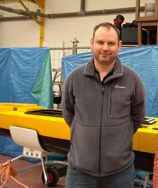
Plans are in place for an expedition to explore the seabed of the Adriatic for signs of early human settlement. Dr Simon Fitch, a geo-archaeologist at the University of Bradford is to embark on a mission to map submerged ice age landscapes and sunken settlements in what has been described as “a first of its kind”, scientific enquiry.
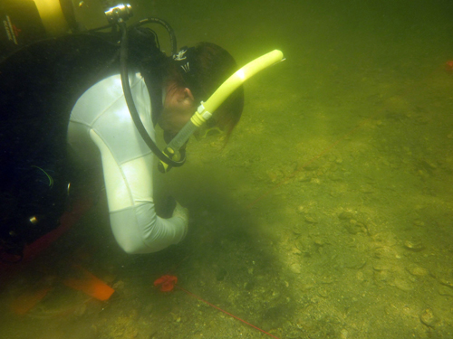
At the end of the month (March 2023), Dr Fitch will travel to Split in Croatia to begin a five-day survey of the Adriatic seabed using state-of-the-art underwater 3-D seismic sensors.
Mapping Parts of the Adriatic and the North Sea
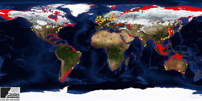
This expedition is the first of several that are being planned. Over the next five years, the researchers hope to map parts of the Adriatic and the North Sea. The North Sea being an area of particular interest to University of Bradford archaeologists as they have previously worked extensively on Doggerland, the huge tract of land that once linked Britain to continental Europe.
To read a recent article about research from the University of Bradford examining the impact of ancient Tsunamis on Doggerland settlements: Ancient Tsunamis Once Devastated Doggerland.
Between 24,000 and 10,000 years ago, global sea levels were around a hundred metres lower than they are today. This latest expedition is part of a long-term project to explore the archaeology of submerged human settlements.
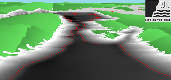
The Life on the Edge Project
The Life on the Edge project is part of a UKRI future leaders fellowship for Dr Fitch, which last year attracted just over £1m in funding from UKRI, as well as £400,000 in-kind ship time from VLIZ (Flanders Marine Institute), and a PhD studentship from the University.
The University of Bradford’s Faculty of Life Sciences now has the largest submerged landscapes research group in the world and is one of the few places specialising in this exciting area of academic research.
Commenting on the significance of the study, Dr Fitch stated:
“This is the first time anyone is going more than 500 metres from the coastline in the Adriatic to map the seabed. We know humans once lived on the land down there because trawlers regularly dredge up artefacts. This is about finding out who we are as a species and where we come from”.
An Incomplete Picture of Our History
Dr Fitch went onto explain that we have an incomplete picture of our own history. During the Late Palaeolithic (24,000 to 10,000 years ago), our planet was in the grip of an Ice Age and during this time we experienced the last “glacial maximum”, when sea levels were much lower than today, due to the amount of water stored in the ice caps and glaciers. More land around coasts would have been exposed and it is very likely that Stone Age people lived in these areas.
Dr Fitch added:
“We know most human populations like to live on the coastline, so it’s likely there were settlements on what is now the seabed. Our aim is to find evidence of those settlements and then recover the archaeology.”
Helping Renewable Energy Companies
Archaeologists from Bradford University along with collaborators from the University of Split and Flanders Marine institute (VLIZ), are working with commercial companies, who are already mapping the seafloor as they prepare to construct wind farms.
Powerful supercomputers installed at the University of Bradford are being used to process the huge volumes of data the expeditions will produce and The Life on the Edge Project has already attracted attention from other archaeologists based overseas. Dr Jessica Cook Hale (University of Georgia, USA), is to join the project.
The Search for Sunken Settlements
The academic is an experienced archaeologist with over two decades of research and field work behind her, including having dived underwater prehistoric sites in the Gulf of Mexico and the Atlantic coast.
Dr Cook Hale commented that she was excited to be joining this project and stated:
“Bradford is one of the few places doing this. I looked at this project from afar and wanted to be a part of it, so I’m thrilled to be joining the team. Carrying out geo-archaeology on submerged landscapes is really the only way to approach the problem of finding out about our prehistoric ancestors. As archaeologists, we’re naturally curious, we always want to ask, what came before?”
Training the Next Generation of Geo-archaeologists
One of the aims of the project team is to help recruit and train the next generation of geo-archaeologists.
The Life on the Edge project is an appropriate moniker, the team will be using cutting-edge mapping and computer technology and they will be exploring places that no archaeologists have explored before.
We wish the team every success with this intriguing venture.
Everything Dinosaur acknowledges the assistance of a media release from the University of Bradford in the compilation of this article.