Exploring the Ancient Landscape Under the Irish Sea
A team of international scientists are setting out to map and explore the extensive submerged prehistoric landscape that lies under the Irish Sea. The research team includes members of the Irish Marine Institute and the Institute of Technology Sligo and the University College Cork and they aim to explore the prehistoric landscape and search for evidence of human activity and habitation.
At the end of the last Ice Age, huge areas of habitable land in Europe were flooded as sea levels rose. Scientists estimate that the water rose by around 120 metres, (as a guide, St Paul’s Cathedral is around 111 metres tall), beneath the waves lies a virtually unknown palaeolandscape of plains, hills, marshlands and river valleys.
A Map Showing the Maximum Extent of the Marine Palaeolandscapes
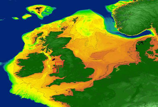
Picture credit: University of Bradford
A Prehistoric Landscape Similar to Doggerland
The researchers are confident that the palaeolandscape between Great Britain and Ireland will be similar to that of Doggerland, an area of the southern North Sea and currently the best-known example of a palaeolandscape in Europe. Doggerland has been extensively researched by Professor Vince Gaffney from the University of Bradford, Principal Investigator of the “Europe’s Lost Frontiers” Project.
The “Last Frontiers” Project
Lost Frontiers is an ERC-funded Advanced Grant project based at Bradford University (West Yorkshire). The purpose is to better understand the transition between nomadic, hunter gathering populations to sedentary farming communities in north-western Europe. The “Lost Frontiers” team are studying the evidence for inundated palaeolandscapes around the British coast using seismic reflectance data sets to generate topographical maps of these hidden landscapes.
Environmental data from these areas is then being used to reconstruct and simulate the palaeoenvironments of these areas using ancient DNA extracted directly from sediment cores as well as traditional environmental data.
Professor Gaffney commented:
“Research by the project team has also provided accurate maps for the submerged lands that lie between Ireland and Britain and these are suspected to hold crucial information regarding the first settlers of Ireland and adjacent lands along the Atlantic corridor.”
Drilling Sediment Cores to Explore an Ancient Submerged Landscape
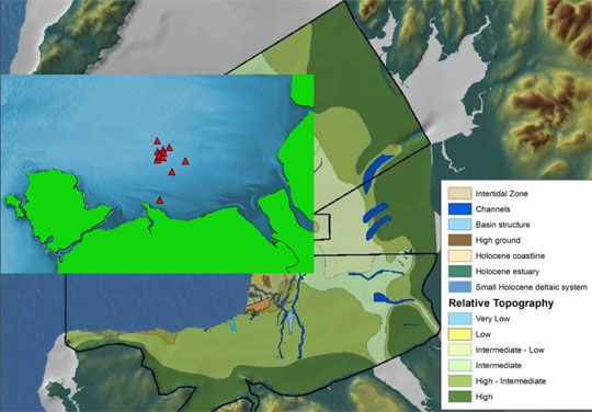
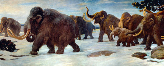
Around sixty sediment cores are going to be drilled at twenty carefully selected sites in Liverpool and Cardigan Bays, these cores will then be analysed by the research team in order to build up a picture of how the landscape changed over time. Analysis of plant spores and pollen will help to establish the type of landscape that once existed under the waves, from this and using Doggerland research as a benchmark, the existence of different types of megafauna can be inferred.
The Coastal Vessel RV Celtic Voyager Will be the Base of Operations
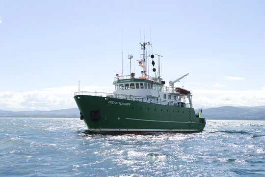
Picture credit: Bradford University
Commenting on the significance of this research Dr James Bonsall (Institute of Technology Sligo), stated:
“It is very exciting, as we’re using cutting-edge technology to retrieve the first evidence for life within landscapes that were inundated by rising sea levels thousands of years ago. This is the first time that this range of techniques has been employed on submerged landscapes under the Irish Sea. Today, we perceive the Irish Sea as a large body of water, a sea that separates us from Britain and mainland Europe, a sea that gives us an identity as a proud island nation.”
Dr Bonsall added:
“But 18,000 years ago, Ireland, Britain and Europe were part of a single landmass that gradually flooded over thousands of years, forming the islands that we know today. We’re going to find out where, when, why and how people lived on a landscape that today is located beneath the waves.”
Reconstructing Ancient Landscapes
The researchers hope to reconstruct and simulate the palaeoenvironments of the Irish Sea, using ancient DNA, analysed in the laboratories at the University of Warwick, and palaeoenvironmental data extracted from the sediment cores. This information will help the team to build up a picture of the lives of the people who once lived on the land between what is now Ireland and Great Britain.
Mapping the Palaeolandscapes of the Irish Sea
Picture credit: Bradford University
Dr Martin Bates (University of Wales) added:
“This is a very exciting opportunity as the cores we are collecting are the first drilled in the Cardigan Bay sea bed since perhaps the 1970s. They are going to provide us with material that will really help us to understand how Cardigan Bay changed as the sea flooded across the landscape during the time that people were coming back to Wales after the last glaciation.”
Everything Dinosaur acknowledges the help of a press release from the University of Bradford in the compilation of this article.
Visit the Everything Dinosaur website: Everything Dinosaur.



Leave A Comment