Looking for a “Lost Continent” Under the Indian Ocean
Madagascar, may not be the largest island in the world (official estimates place it fourth), but it is regarded as the oldest. Such has been the long period of isolation between Madagascar and Africa/India that something like 85% of the indigenous fauna and flora of the island are found nowhere else on Earth. There are the famous lemurs of course, but something like half of the island’s bird species are exclusive to Madagascar and more than sixty percent of all the plant life. This island was once part of a huge southern super-continent called Gondwana, but the history of this landmass goes back a lot further – into the Cryptozoic.
A Planet in Constant Motion
Our planet is a world in constant motion when one considers the geological time-scale. A patchwork of interlocking crustal plates carry the continents and these are in motion with each other. These movements throughout deep time have changed the position of landmasses in relation to each other, great oceans have opened up and then become closed again. Scientists have identified a sliver of ancient land that once joined India and Madagascar together.
During the Cretaceous period, this landmass (Gondwana), which consisted of Africa, South America, Antarctica, Australia, India and of course the land that was to become Madagascar, began to break up. From a vertebrate palaeontology perspective this break up of the super-continent may have led to the increased diversification amongst many terrestrial vertebrates as communities of animals and ecosystems became separated and new habitats formed.
Madagascar Isolated
Sometime towards the end of the Mesozoic (the end of the Cretaceous – Turonian to Coniacian faunal stages), Madagascar started to split away from the continental landmass that was to move northwards, collide with the southern flank of the Asian continental plate and become India, Madagascar was finally isolated and all alone.
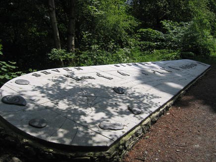
The Break Up of Gondwana (southern Super-continent)
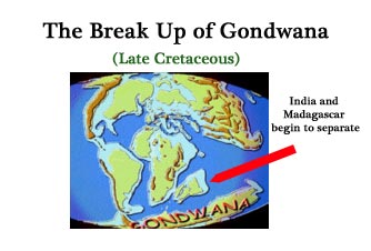
The breaking up of a super-continent.
However, a team of international scientists, including researchers from the United Kingdom claim to have identified remains of the ancient landmass that once linked India and Madagascar together, quite a feat when one considers this research involved examining tiny sand grains on a Mauritian beach as well as exploring hundreds of thousands of tonnes of igneous rock on the floor of the Indian Ocean.
Lost Continent
This continental fragment, once part of Gondwana is referred to as Mauritia, it detached some sixty million years ago (Palaeogene), becoming buried under vast quantities of volcanic rock.
The theory of plate tectonics suggests that rising plumes of hot, molten material from deep within the Earth’s mantle under what was to become Madagascar began to stretch and weaken the planet’s crust. Eventually, the crust rifted apart and molten material filled in this rift. This led to the separation between India and the land we now know as Madagascar.
Writing in the academic journal “Nature Geoscience”, the international team of geoscientists suggest that such continental fragments may occur more frequently than previously estimated. Hot-spots in the Earth’s crust being caused by mantle plumes situated underneath the volcanic islands of Reunion and Marion in the Indian Ocean seem to have played a role in the break up of the final remnants of Gondwana and the formation of the Indian Ocean.
If this rifting apart due to the affect of mantle plumes lies at the frontier of a continental landmass, in this instance the land that was once India and Madagascar joined together, fragments of this land may be broken off and trapped within the expanding area of molten rock.
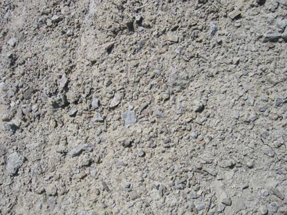
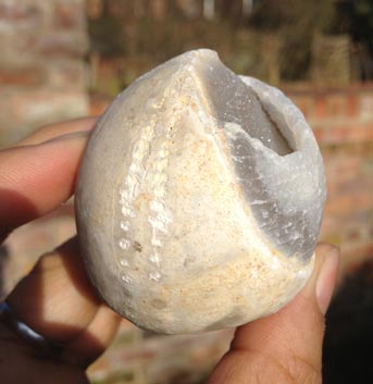
Scientists from South Africa, Norway, Germany and the United Kingdom examined in microscopic detail samples of sand taken from the volcanic beaches of the island of Mauritius. The sand grains could be dated back to a volcanic eruption some nine million years ago but some of the minerals they contained proved to be very much older.
Dating the Crust
Semi-precious minerals known as zircons indicate an origin in continental crust and they are extremely old, being dated between 1.97 billion years and 600 million years old. The researchers concluded that these grains were the remnants of an ancient area of land that had been dragged up to surface of the island during the relatively recent (in geological time), volcanic activity. Professor Torsvik, one of the authors of the research stated that he believed that parts of the landmass called Mauritia could be found about ten thousand metres down beneath the island of Mauritius and under the Indian Ocean.
Extensive dating techniques were applied to the zircon samples in order to establish the age of this material. What was once thought to be geology representing the trail taken by the Reunion hot-spot as the crust moved, is now being interpreted as ancient pieces of a continent that long since perished and ended up being covered by igneous rocks as a result of the activity of the Reunion mantle plume.
Dating techniques such as radio-carbon dating and magnetostratigraphy are helping geologists to understand more about the age of rocks. Plate movements have had a huge impact on the evolution and distribution of life. Landmasses converging brings different communities together in competition, whilst diverging landmasses such as that which took place with the break up of Gondwana separates organisms.
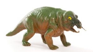
Fossils of Lystrosaurus, a synapsid reptile known from Late Permian to Early Triassic strata have been found in Antarctica, India, Madagascar and Africa indicating that these land masses were joined together in the past. Lystrosaurs were a very successful group of terrestrial reptiles, one of the most numerous animals on Earth for much of the Early Triassic.
For replicas and models of early synapsids and other prehistoric animals: Prehistoric Animal Figures – CollectA Deluxe.
A Very Numerous and Widespread Resident of a Gondwana – Lystrosaurs
A Placerias model a typical dicynodont. Picture credit: Everything Dinosaur.
We suspect that holiday makers, sunning themselves on the beautiful beaches of Mauritius are unaware that the sand they are sitting on provides evidence of an ancient landmass, other remnants of which lie buried under the vast Indian Ocean.


")


")