
A new digital tool has been developed to help archaeologists map the location of ancient Doggerland settlements. The interactive tool has been developed by researchers at the University of Bradford (UK). It charts the evolution (and demise) of the Ice Age landmass that once connected Britain to mainland Europe. This innovative technology has been developed as part of a large project entitled “Unpath’d Waters”. The objective is to map all the sunken land associated with the British Isles during the last glacial maximum.
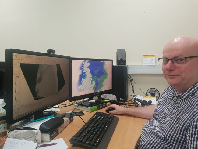
Dr Philip Murgatroyd project modelling lead with map showing Doggerland. Picture credit: University of Bradford.
Picture credit: University of Bradford
How Doggerland Changed over 20,000 Years
The simulation tool is available on YouTube. In addition, an animation has been uploaded illustrating how Doggerland changed over 20,000 years. The animation begins at the height of the last glacial maximum when sea levels were at their lowest. Furthermore, it moves forward in time to around 5,000 years ago when Doggerland was finally fully submerged.
The animation and simulation depict Doggerland as a country stretching across the North Sea, then shrinking to an archipelago, then a single island. Finally, all the land is swallowed by the waves. The inundation of this area of land was precipitated by an event known as the Storegga tsunami, which followed an underwater landslide roughly the size of Scotland that occurred off the coast of Norway about 8,000 years ago.
The creator of the interactive, digital map and the Doggerland animation is Dr Phil Murgatroyd (University of Bradford).
He explained:
“This interactive map is available to anyone to download and use, it shows the area of the North Sea that once comprised Doggerland – a land bridge between the UK and Europe, which is now beneath the waves. The map allows people to see what the landscape looked like from 5,000 years ago all the way back to 20,000 years ago. The landscape is constantly transforming. It used to be above the sea, now it’s below the sea. This simulation provides a tool to see how that unfolded.”
Free to Use Software
The software is free to access and download. It can be easily controlled by an X-box compatible game controller. In addition, it can be operated using a standard Windows PC. The simulation forms the base of a more sophisticated version for home use. Simulated humans live within the small-scale environment and the user can influence their activities. This version is currently under development.
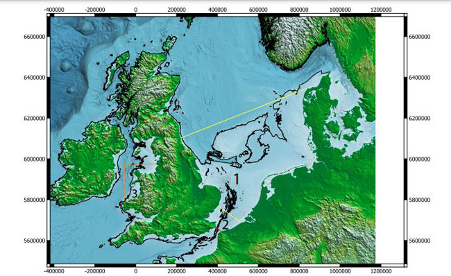
A digital map showing the location of Doggerland. This interactive tool can help archaeologists search for ancient Doggerland settlements. Picture credit: University of Bradford.
Picture credit: University of Bradford
To read an article from 2023 about a grant awarded to the University of Bradford to explore underwater landscapes: Prehistoric Landscapes Research Project.
Hunting for Ancient Doggerland Settlements
The researchers are using artificial intelligence (AI) to help them locate “Goldilocks zones”. These are areas where human settlements are likely to be found. The AI will help pinpoint evidence of ancient Doggerland settlements under the North Sea. In total, an area of seabed roughly the size of England and Scotland combined has been mapped. The AI will be used to narrow down the search for evidence of Stone Age settlements. Once above the sea, they were gradually inundated by successive sea-level rises, disappearing beneath the waves about 8,000 years ago.
Commenting on the significance of this new technology, the leader of Bradford’s Submerged Landscapes Research Centre, Professor Vince Gaffney stated that surveys of ancient landscapes can provide a better understanding of climate change.
The professor added:
“So far, the only evidence we have that people once actually lived on what is now the bottom of the North Sea – and other oceanic areas – have been chance finds dragged up by accident by trawlers or through dredging. But do we know people once lived on what is now the seabed? It’s a certainty, it’s just a case of identifying what we call the ‘Goldilocks zone’, which combines three variables: whether people lived there, whether evidence of that has been preserved, and whether it is still accessible today.”
The AI can be used to help the archaeologists make predictions about the likely location of ancient Doggerland settlements.
A Harpoon Made from a Red Deer Antler
In 1931, a trawler named Colinda dragged up a harpoon sixty miles off the Yorkshire coast. This artefact is known as the “Colinda Harpoon”. The object is a fraction under twenty-two centimetres in length. It is a beautifully crafted fish harpoon made from an antler from a Red deer. Recently, archaeologists announced the discovery of an 11,000-year-old stone wall (originally built on dry land) in the Bay of Mecklenburg between Denmark and Germany. This is the latest in a series of underwater finds that point to a time when humans inhabited vast areas of the European Continental shelf, much of which is now under water.
Professor Gaffney commented:
“The only lands on Earth that have not been explored in any depth by science are those that have been lost to the oceans. Global warming at the end of the last Ice Age led to the inundation of vast landscapes that had once been home to thousands of people. These lost lands hold a unique and largely unexplored record of settlement and colonisation linked to climate change over millennia. Amongst the most significant is Doggerland. Occupying much of the North Sea basin between continental Europe and Britain it would have been a heartland of human occupation and central to the process of re-settlement and colonisation of north-western Europe during the Mesolithic and the Neolithic.”
However, because much of that land has already been earmarked by the Government for offshore wind development, including the world’s largest wind farm, archaeologists are keen to work with developers to ensure archaeological concerns are heard.
Everything Dinosaur acknowledges the assistance of a media release from the University of Bradford in the compilation of this article.
Visit the award-winning Everything Dinosaur website: Prehistoric Animal Models and Toys.


Leave A Comment